Today I did some testing on JS8call with the idea of using it for Safety and Welfare communications on community events. I saved 8 waypoints on a 80 km perimeter around my home station at 465m ASL.
Next job was to drive the loop and set up my portable station at every waypoint and see if I could communicate with home. I was certain it would work ok but I just needed to test the signal paths and levels of power required to get back to Home. I chose my way points at the bottom of a gully or near the edge of the hills all check points were lower than home.
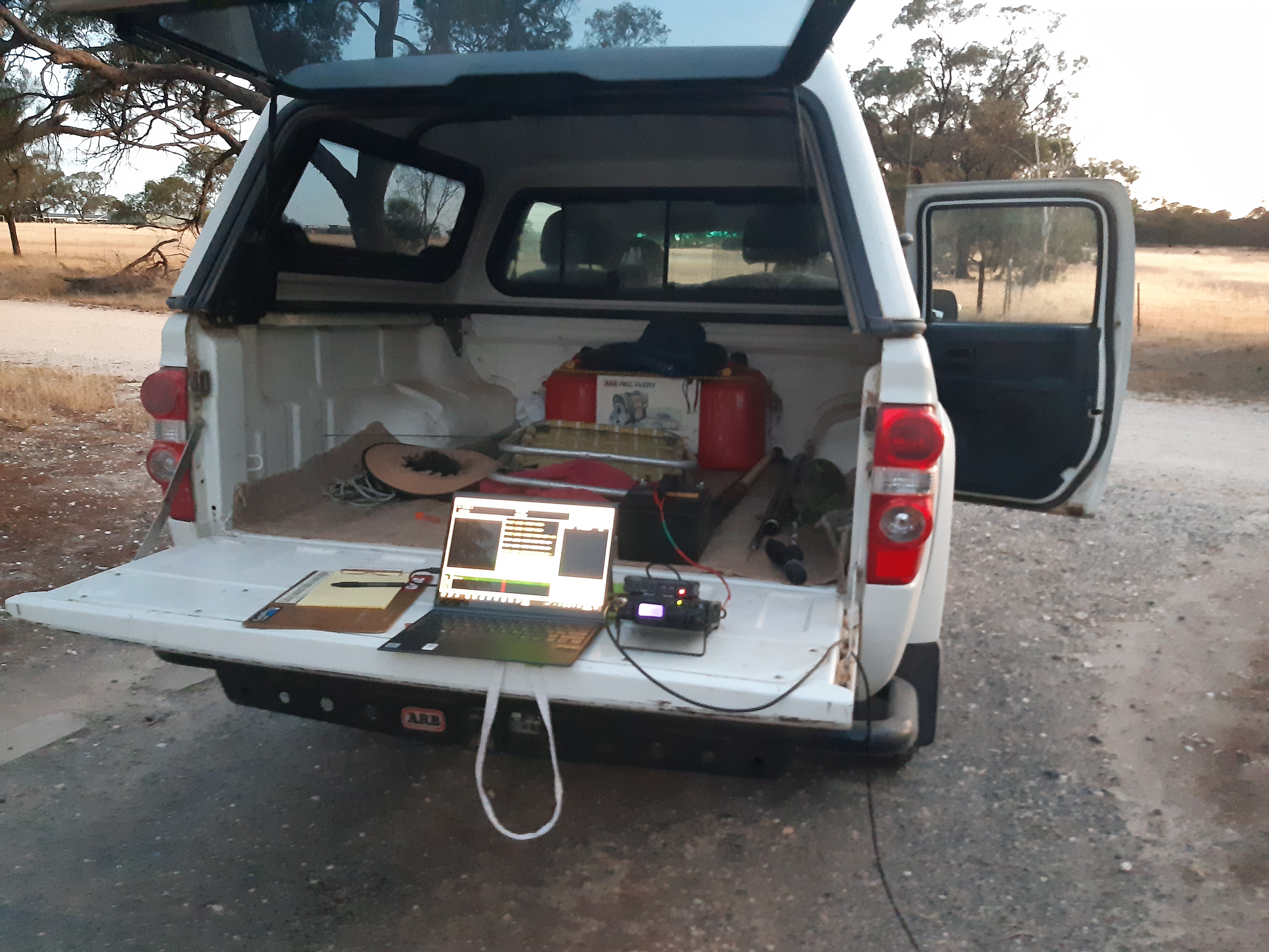
Choice of radio in my FT 817 and SCU 17 data interface. Powered by a LiFe PO 4 30amp hour battery I had plenty of power for the job. Antenna is a Flower pot half wave vertical dipole and fed with 5m of cell foil coax and a 3 meter pole to set the antenna on.
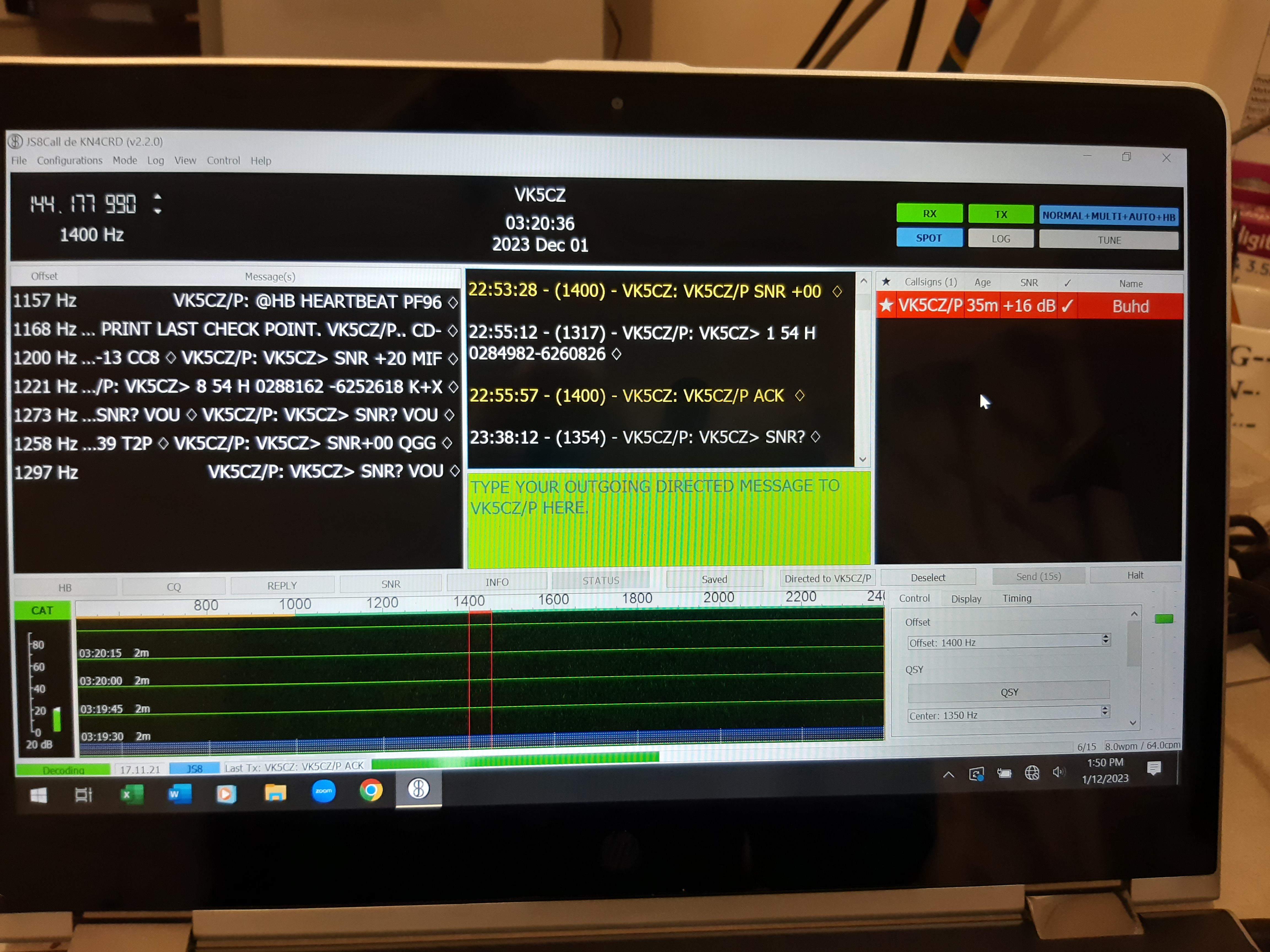
The tail board of my Ute is ideal for the job as a place to set up the kit and test the path. First thing to do once arriving at the waypoint and setting up is put the correct Locator grid reference in the JS8 software then select the call sign of the home station and request an SNR from home to see if I am being heard. Every check point chosen I was able to hear and be heard from VK5CZ and get a signal report and pass a message.
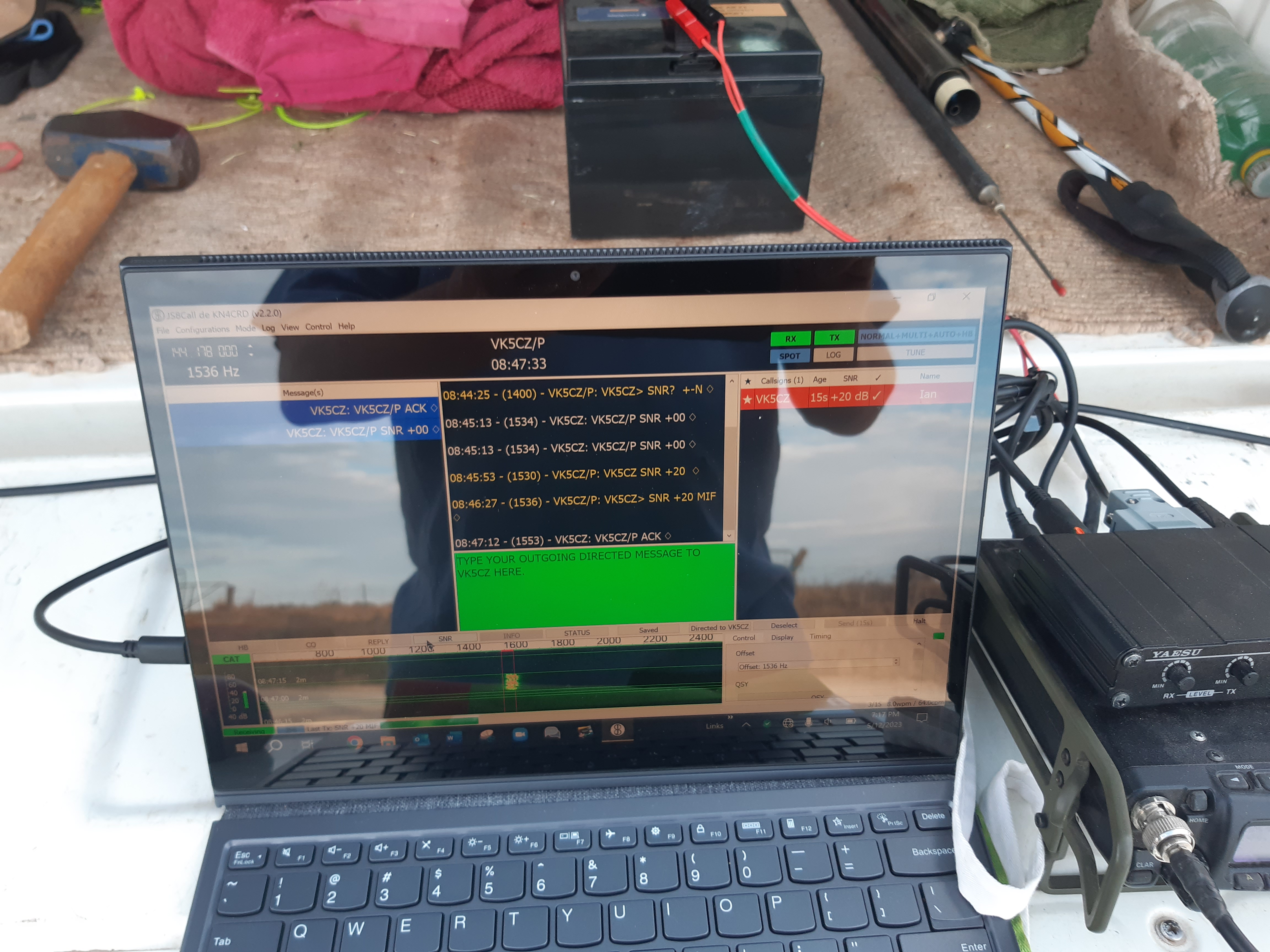
Here is my station talking to VK5CZ home from VK5CZ/P portable station. I chose 4 watts of power with zero ALC on the radio and used 144.178 the 2m VHF allocation for JS8 mode on Upper Sideband.
The first thing is request an SNR to see if I am heard then once comms is established I sent the check point number starting from NO 1 and the exact UTM grid reference determined by my Garmin 65s GPS on arrival at the different check points. This took 4 x15 second transmissions of DATA so 1 minute of air time then a further 2×15 second transmissions reporting back to VK5CZ the received SNR at VK5CZ/P with an ACK [acknowledgement ] from VK5CZ . Then I would tear down and move to the next check point.
From Home I set my FT991a running on an X200 vertical at 45 feet power was 20w, judging by the signal levels from VK5CZ I probably could have set it at 5 watts also. Because I was doing the exercise by myself I made sure my home station software was set up correctly with my VK5CZ/P call sign in the heard box and selected in RED as well. Because I had to leave it running remote like this I could not use the Beacon HB+ACK feature hence the SNR requests from the field was a way to see if I was being heard.
This is my Home screen showing the traffic passed with ease from all of my waypoints around the course driven for the day. The first 3 checkpoints I set the power to 4 watts on my FT817 but started to see that much power was not necessary to get through. Checkpoint 4 down south of Clare behind Mount Horrocks needed the full 4 watts to get in but after that check points 5 6 7 got in with 3 watts and check point 8 got in with 1 watt.
A typical Transmission was sent as a direct message to Home and ACK reply once message was received.
At Home Base Highlighted in RED was VK5CZ/P and left running that way for the whole exercise.
Check point 1 was sent as Highlight in RED VK5CZ in the heard box once SNR was reported back.
>greater than symbol at head of a msg lets the Home base know you need an ACK returned on receipt of the sent message.
All stations Hearing each other get a white star along side the callsign in the Heard box.
Locator for checkpoint 1 is PF96IF14 put in software on arrival.
Exact GPS UTM coordinates determined on Garmin 65s.
>54 H 0284982 6260826 [ENTER]
VK5CZ reply ACK.
Send VK5CZ station SNR reports back with an ACK.
Message sent pack up move to next checkpoint.
Home locator is PF96HD55
Checkpoint DATA
1 PF96IF14 path is 10.3km Height ASL 230m TX PWR 4w
2 PF96GE14 path 11.3 km Height ASL 180m TX PWR 4w
3 PF96GB57 path 11km Height ASL 200m TX PWR 4w
4 PF95HX48 path 16.8km Height ASL 400m TX PWR 4w
5 PF95IX28 path 17.8 km Height ASL 342m TX PWR 3w
6 PF96IA68 path 15.2 km Height ASL 355m TX PWR 3w
7 PF96IC86 path 10.6 km Height ASL 435m TX PWR 3w
8 PF96ID57 path 8km Height ASL 432m TX PWR 1w
My next plan will be a bigger loop creating a larger foot print area trying to push JS8 on VHF even harder.
Its now later in the month of December, and after a rather hot day I got another set of Way points on a 150 km radius and went about doing a night time test this time.
First check point was an 18km path from Western side of Clare Valley out in the flatter Blyth plains on the way to Hoyelton.
Good signal levels with a 1w transmission from the portable station.
Still daylight at this time but I slowly headed into darkness for the next check point.
Check point 3 was further Est South from home but still good signals can’t kill JS8 over these distances on VHF.
Checkpoint DATA.
1 PF96GA13 path is 18 km H ASL 207m pwr 1 w snr +00 +20.
2 PF95HV45 path is 28 km H ASL 193 pwr 3 w snr -05 +02
3 PF95IV79 path is 34 km H ASL 348 pwr 3 w +00 +17
4 PF95KW36 path is 32 km H ASL 446 pwr 3 w +00 +01
5 PF96KB54 path is 25 km H ASL 480 pwr 1w +14 +20
6 PF96II92 path is 23km H ASL 441 pwr 1w +00 +21
Judging by those results it proves the viability of JS8 as a good package for short range check point type communications between stations and an easy method of passing information.
Maybe my home station with lower power and a unity gain antenna lower to the ground would help put js8 under more pressure to work. But seeing all signals were in the plus snr levels in both scenarios JS8 can still work reliably down in the minus db levels.